Our coast: Brough
This article is our latest post on our seaweed harvest sites around Caithness. Brough is one of our smallest sites, but the rocks and cliffs make it one of the most beautiful. It is on the eastern side of Dunnet Head, the most northerly point of the British mainland. Brough has proven to be a useful site for harvesting a variety of species, thanks to the shelter provided by the surrounding cliffs.
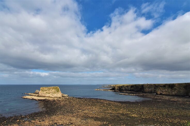
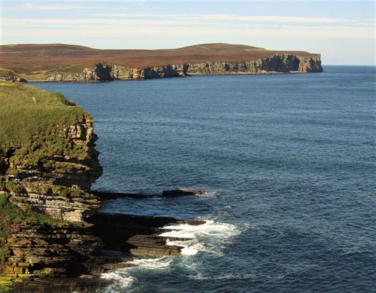
Clifftop view over our harvest site at Brough, looking east beyond the islet of Little Clett
A stunning rocky bay on the Caithness coastline
First of all, let’s clarify the pronunciation of this site. Unlike namesakes in other parts of the UK, our Brough is pronounced to rhyme with that most Scottish of words ‘loch’. While it is likely that Brough is taken from the Gaelic word ‘bruthach’ – meaning steep bank or brae – some believe it originates from the many ancient fortifications called brochs that are common around Caithness.
Rocky cliffs and grassy slopes surround the bay. A steep track provides access to the shore from the road out of the village of Brough. The peaks of Little Clett in the bay dominate the view. The word ‘clett’ is from ‘klettr’ in Old Norse, meaning uninhabited rocky islet. It is used in various placenames around Caithness, including the village of Sarclet on the east coast. Little Clett can be reached at low water on most tides, but crossing the bouldery causeway carries the risk of being cut off by rising seas. Our seaweed harvesters tend to leave Little Clett to the resident seals.
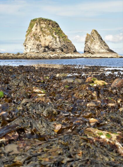
The rocks of Little Clett beyond wrack and kelp thriving on the low shore
The area was once noted for its access to excellent fishing grounds for salmon and herring. The old fishing station and store still overlook the bay. Brough was once known as the "Village of Captains" because it was the birthplace of many successful mariners. The site lies on a geological fault marking the boundary between old red sandstone rocks to the northwest and Caithness flagstones to the east, which have been quarried in the county for centuries and exported around the world. A Norse castle once stood over the bay. Like many historic structures in the Highlands, stones were likely taken for use as building materials and whatever was left eventually succumbed to erosion from the sea.
Small but perfectly formed
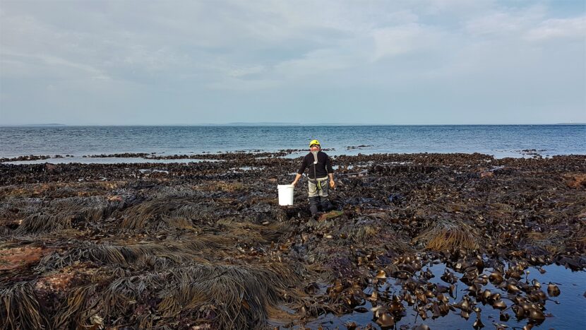
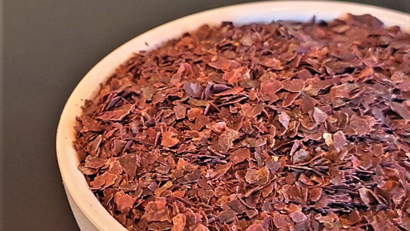
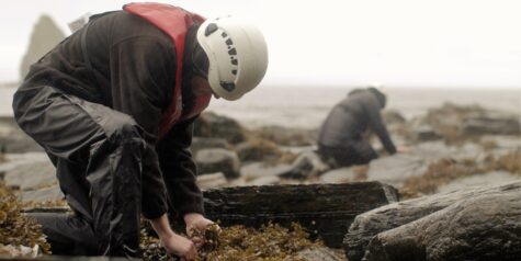
The site is little more than one kilometre long. The eastern boundary is a section of unpassable rocky outcrops, which renders the adjacent shore inaccessible. Similarly, the northern end is marked by a geo – an Old Norse word meaning a gully eroded into a cliff. Being a small site, we did not consider it within our first round of surveys in 2014 as we did not expect it to have large volumes of seaweed. However, the extensive boulders and sheltering cliffs combine to provide excellent conditions for dense growth of a range of species. Our biomass survey in 2018 was slow going because of the thick coverage of seaweed. Dulse is the top harvest species at Brough, but it is also a good site for spiral wrack and knotted wrack.
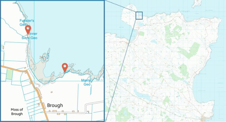
Our Brough harvest site is in a sheltered bay to the east of Dunnet Head
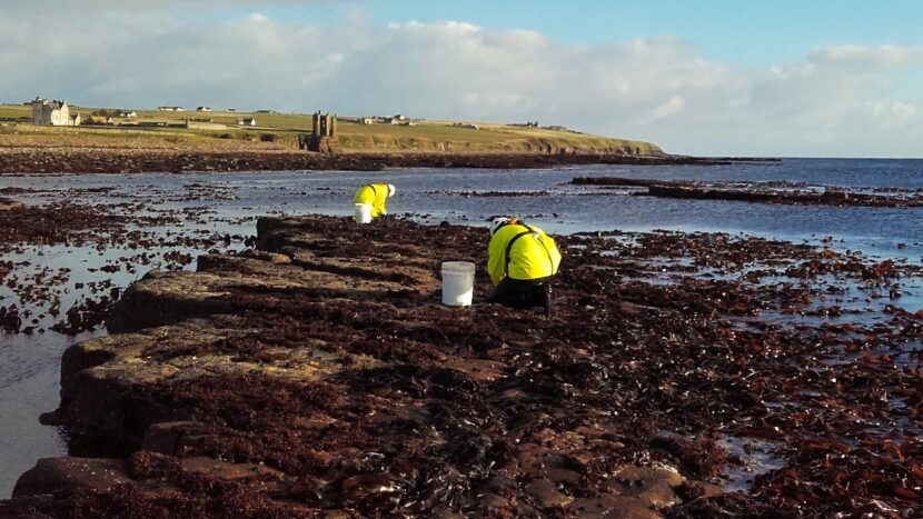
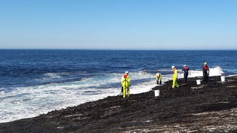
Credit: Contains Ordnance Survey data, Crown copyright and database right 2014Our harvesters are infrequent visitors to Brough, generally picking seaweed on the more expansive harvest sites to the east. The site comes into its own on stormy days. It is one of the few stretches of coastline with cliffs to the southwest, sheltering harvesters from the prevailing wind. Oceanic swells regularly roll in from the Atlantic, which will limit harvesting options on the north coast of Caithness. Brough is neatly tucked in behind the rocky reefs around Little Clett, diminishing the waves enough to allow harvesting during autumn gales.
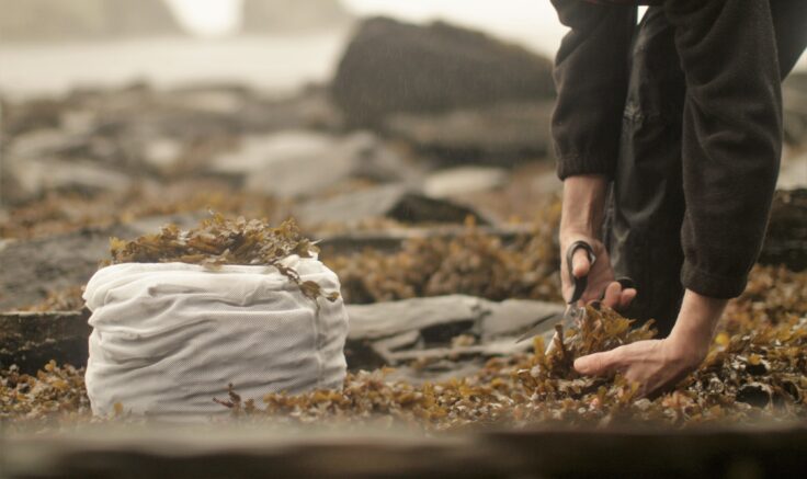
Harvesting wrack at Brough – whatever the weather
The stunning scenery and reliability during inclement weather has meant we have regularly used Brough for promotional photography and filming over the years, including our appearance on the BBC’s Inside The Factory in 2023. However, we need to plan winter harvests with care because icy conditions make the steep track down from the clifftop a touch treacherous.
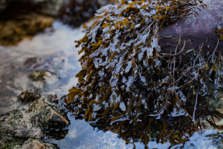
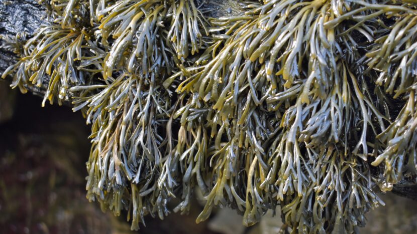
Spiral wrack thrives among the boulders and rockpools on the upper shore at Brough
Dunnet Head
The rugged headland of Dunnet Head dominates the seascape of the north coast, even appearing in Ptolemy's 2nd Century map. Anyone journeying from Land’s End to John O’Groats may be missing out: Dunnet Head is the actually the most northerly point of Caithness, which has parallels to Lizard Point being the most southerly point of Cornwall. Dunnet Head offers the incredible views over to Orkney, being just eight miles across the Pentland Firth from the island of Hoy. This view is a stark reminder to anyone who has journeyed to the very top of Scotland that there are islands further north to explore.
Dunnet Head extends out from the mainland, sheltering Brough Bay from Atlantic storms
A minor road leaves Brough and curves up the untamed headland, eventually reaching Dunnet Head Lighthouse. Perched on the cliff edge 100m above the breaking waves, the lighthouse was built in 1831 by the legendary engineer Robert Stevenson. You can actually stay in this listed building. Heavy storms occasionally throw spray over the cliff face, with stones even reportedly breaking windows. It is within the RSPB reserve and is a designated Site of Special Scientific Interest. Depending on the time of year, visitors can expect to see puffins, fulmars, kittiwakes and razorbills,
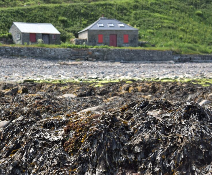
Buildings overlooking our Brough harvest site were once used to store supplies brought in by sea for Dunnet Head Lighthouse
The slipway in the middle of our harvest site was built over two hundred years ago to support the construction of Dunnet Head Lighthouse. It is now managed by Brough Bay Association and is an excellent spot to launch a sea kayak. Buildings by the slipway were once the stores for the lighthouse. Supplies were carried onward up to the top of Dunnet Head by horse-drawn cart.
A haven of tranquility
If you are travelling in Caithness, do not forget to divert off the main road and stop by Brough Bay. It is a haven of tranquility on a stretch of windswept coastline and a guaranteed opportunity to see seals. Anyone interested in learning more about our other harvest sites should check out the article on Ness of Duncansby by Peter Elbourne, which is ten miles to the east of Brough.